As I am
making my way across England following the new trail the 'Way of the Roses' I am thinking about the qualities of the two ends of the route. At the East side there are very ancient water features frozen in chalk while to the West the landscape is newly shaped by water everyday.
The story of the West is that of Morecambe Bay and was told to me by two people: Dr Suzana Ilic of Lancaster University and Cedric Robinson - Queens Guide to the Sands.
Suzana told me a story of a process so random and active that scientists are unable to model it in any useful way - the rivers entering Morecambe Bay carve valleys, dykes and gutters (Cedric's terminology) that are partially erased by each high tide and then cut anew in a slightly different location
 |
| Plan of the Sands - drawn by Olive Robinson |
|
 |
| Geo-Satellite image of Morecambe Bay |
|
|
 |
| One days landscape at lowtide |
|
Crossing the Sands of Morecambe Bay has historically been so dangerous, because of this shifting geography, that a post of Royal Guide to the Sands was created in the era of Henry VIII. This post has been held by Cedric Robinson since 1963
 |
| Cedric Robinson has written 8 books about the culture and landscape of the Sands |
 |
| Guides Farm. Grange-over- Sands |
I had the enormous privilege of spending an afternoon with Cedric and his wife Olive at Guides Farm and hearing about the way they understand the landscape of the Sands. Cedric has guided thousands of people across from Morecambe to Grange - he marks each new route with branches of laurel, markers that will be erased by each big tide, heralding a new topography.
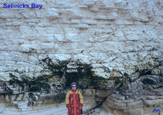
The Yorkshire Wolds, at the Easterly extreme of the route are made of Chalk. Chalk is the layer that was formed at the bottom of long forgotten oceans as the shells and skeletons of countless sea creatures fell to the bottom of the sea and were crushed together over millions of years.
The impressive Flanborough Head is an outcrop of the chalk of the Wolds slowly sculpted by the sea. But the landscape that you travel over just inland is a mysterious land of 'lost water'. The chalk of the rolling Wolds is porous and retains no water (instead it passes down until it reaches clay or hard rock and retained as underground reservoirs).
However this land did have rivers for one (relatively) brief period, the glaciers of the last Ice Age did not reach this far South, but temperatures were so low that the earth was permanently frozen and consequently
impermeable to water, this meant that when there were periodic thaws in the glaciers the melt water formed rivers that ran over the Chalk and quickly cut down through the soft stone. When the temperature rose again the chalk thawed out and became porous again leaving the atmospheric 'Dry Valleys' of the Wolds:
 |
| Dry Valley at Millington |
|
I have a mental image of the Wolds as an ancient 3D 'photograph' of the what us happening today in chaotically active landscape of Morecambe Bay. Whether this 'sticks' and become a significant part of an art project is uncertain as every twist and turn of this 180 mile trip reveals a new potential direction.
 |
| Contemporary active landscape at the end of the Wolds |


Lucky you getting to meet Cedric! He is a total legend! Tristan and Charles came to meet him with me when they were working in Morecambe.
ReplyDelete